
AI
Revolutionizing Agriculture: Advanced Drone Technology for Large Farms
Revolutionizing Agriculture with Smart Drone Technology
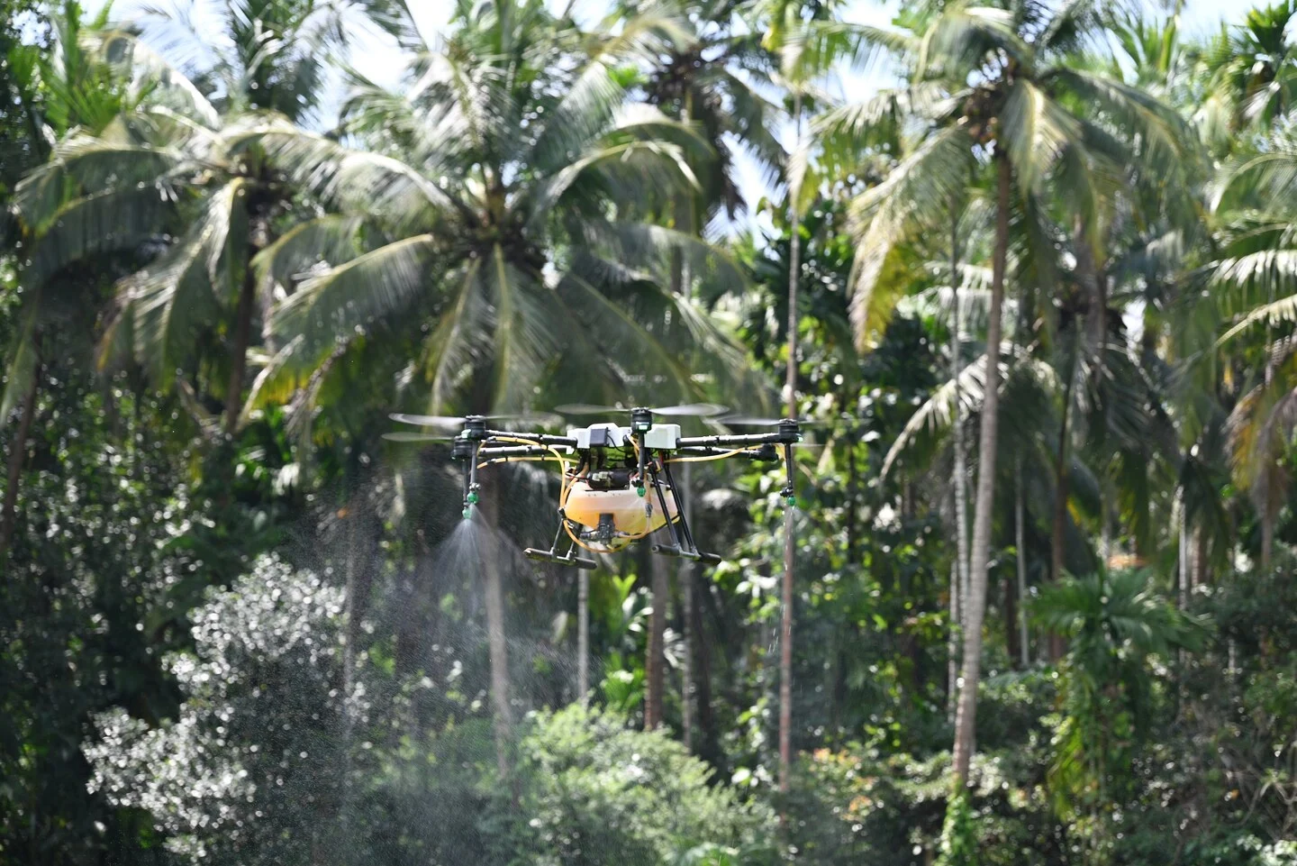
Singapore-based DroneDash Technologies and GEODNET have joined forces to establish GEODASH Aerosystems, a collaborative venture aimed at developing a cutting-edge agricultural spraying drone tailored for large industrial farms. This innovative drone technology eliminates the need to map fields before each flight and adapt flight plans to changing ground conditions.
Enhanced Capabilities for Precision Agriculture
The advanced aircraft is equipped to perceive its surroundings during flight, adjust its behavior based on visual data, and carry out efficient crop spraying operations. Unlike existing agricultural spraying drones, which were repurposed from general-purpose models, the GEODASH Aerosystems drone is specifically designed to streamline operations on large estates, such as palm oil plantations.
Integrating AI and Positioning Technology
GEODASH Aerosystems combines DroneDash’s AI vision system with GEODNET’s positioning correction technology to achieve exceptional accuracy down to one centimeter. The drones can recognize rows, trees, terrain, and operational zones while in flight, making real-time adjustments to altitude and spray rates as conditions vary.
Adapting to Dynamic Agricultural Environments
Unlike traditional deterministic systems, which struggle to cope with unpredictable conditions, the GEODASH Aerosystems drone excels in dynamic environments. It can autonomously make real-time decisions, recognizing and responding to changing plant growth and environmental factors without the need for pre-existing maps.
Empowering Precision Farming Practices
The drone’s dual functionality as a spray applicator and aerial sensor platform provides valuable data to farm operators. Metrics on canopy density, plant health, spray effectiveness, and terrain profiles are fed into DroneDash’s AI Smart Farming backend, enabling informed decision-making for optimized agricultural practices.
Commercial Deployment and Future Plans
GEODASH Aerosystems plans to deploy its technology initially in palm oil plantations in Southeast Asia, row-cropping operations in the US, and large estates in South America. Following successful pilot deployments and validation projects, commercial deployment is scheduled for the third quarter of 2026.
(Image source: “Agriculture drone new technology” by Shreesha Sharma is licensed under CC BY-SA 4.0. To view a copy of this license, visit https://creativecommons.org/licenses/by-sa/4.0)
Interested in AI and Big Data Innovation? Explore the latest trends and insights at the AI & Big Data Expo events in Amsterdam, California, and London, co-located with TechEx’s leading technology events.
This article is brought to you by TechForge Media. Discover upcoming enterprise technology events and webinars here.


Apple Music and Apple One: Pricing Updates and Changes

Revolutionizing Life with Enhanced 3D Printing Technology

Exclusive Interview: GWM Australia COO John Kett Reveals Insider Insights

Fallout 5: A New Chapter Unveiled Amidst Xbox’s Mass Layoffs

Case of Mistaken Identity: Russian Tourist Detained in Armenia for Alleged REvil Hacker Activity

I would defend diversity with all my might: The Sims artist’s battle against mandated homogeneity post-EA Saudi acquisition

Greenjets secures €35 million Series A funding with NATO support for cutting-edge aerospace technology

Apple Music Subscription Prices Set to Increase

The Secret strategy of OnePlus

EU Takes Action Against Instagram and Facebook for Violating Illegal Content Rules

Warning: Facebook Creators Face Monetization Loss for Stealing and Reposting Videos

Facebook’s New Look: A Blend of Instagram’s Style
Facebook Compliance: ICE-tracking Page Removed After US Government Intervention

Facebook and Instagram to Reduce Personalized Ads for European Users

InstaDub: Meta’s AI Translation Tool for Instagram Videos

Reclaim Your Account: Facebook and Instagram Launch New Hub for Account Recovery

Meta discontinues Messenger apps for Windows and macOS

Breaking Updates: Meta Connect 2025 Unveils Latest Developments
The Secret strategy of OnePlus

Why DxOMark Smartphone Camera Scores are Wrong

30 Amazing Android SECRETS, TIPS and TRICKS

Android 10 – THIS is why you should be Excited.

The Next OPPO Find X could be very Different…

Honor View20 is a Big Deal – Here’s why

Article 13 – The Future of Mrwhosetheboss.

If THIS is the Huawei P30 Pro…

12 Smartphone Gadgets for 2019.
-
 Facebook9 months ago
EU Takes Action Against Instagram and Facebook for Violating Illegal Content Rules
-
 Facebook9 months ago
Warning: Facebook Creators Face Monetization Loss for Stealing and Reposting Videos
-
 Facebook7 months ago
Facebook’s New Look: A Blend of Instagram’s Style
-

 Facebook9 months ago
Facebook Compliance: ICE-tracking Page Removed After US Government Intervention
-
 Facebook7 months ago
Facebook and Instagram to Reduce Personalized Ads for European Users
-
 Facebook9 months ago
InstaDub: Meta’s AI Translation Tool for Instagram Videos
-
 Facebook7 months ago
Reclaim Your Account: Facebook and Instagram Launch New Hub for Account Recovery
-
 Apple9 months ago
Meta discontinues Messenger apps for Windows and macOS